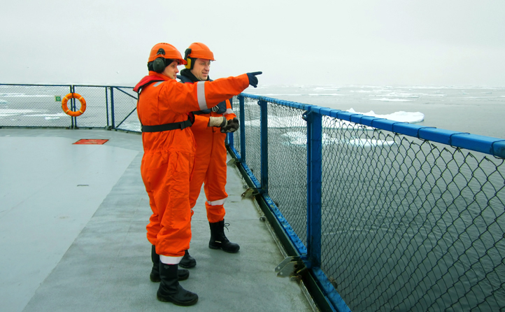
SMNG has a geodesic department, providing positioning services for the company vessels to ensure companies operations both in the Russian Arctic and worldwide.
The geodesic department specialists have worked out an integrated navigation system RGP-2D (INS RGP-2D), specially designed for managing 2D shooting. The system is protected by patent.
At present INS RGP-2D is installed on two SMNG shallow water vessels. To process navigation data, Navtest program system designed also by SMNG specialists is used onboard these vessels.
Deepwater vessels of SMNG are equipped with Spectra and Orca integral navigation complexes by ION Concept Systems.
The geodesic department utilizes state-of-the-art high accuracy technologies to produce a position of the vessels and technological equipment at geophysical surveys.
SMNG has a long-term service agreement with Fugro Survey AS providing equipment and differential signal. Services Fugro StarFix XP and Fugro StarFix G2 are global high-accuracy (0.1 m in plan) PPP-services, without reference to the remoteness from the base stations. StarFix XP and Fugro StarFix G2 (GPS+GLONASS) are also independent positioning systems, as they use different sets of corrections– XP corrections from JPL, аnd G2 – from Fugro.
On the request of the customer SMNG also utilize the equipment and signal of VERIPOS and C-Nav companies.
SMNG’s vessels are equipped with several positioning systems integrated by navigation sets with other course indicators, depth sensors, streamer positioning sensors, air gun indicators etc. As a rule, this advanced equipment is manufactured by the international leading companies:
- SG Brown Meridian, Sperry Marine Navigat X MK gyro;
- Echo sounders by SIMRAD, DESO and RESON, Kongsberg EM710 Multibeam Echo sounders;
- Hydro acoustic steamer positioning systems by Sonardyne;
- Tail buoys with Fugro Sea Track positioning system and others.
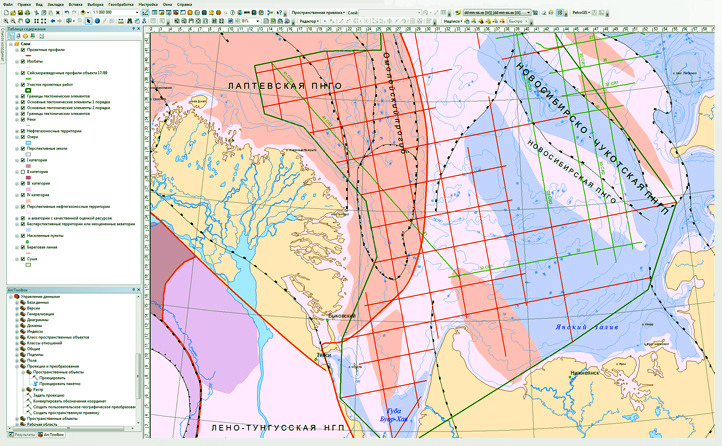
An office team of the geodesic department shadows field operations starting from the design phase, calculation of 2D survey grids, optimization of 3D contours, selection of optimal processing flow up to control of the processed navigation data and generation of report plots.
Another important objective of the office team is the development of geoinformation system (GIS) designed by SMNG. This system integrates geographic, geologic and geophysical data, information on license areas, drilled wells and local structures of the Russian Arctic Seas.
SMNG uses the software of ESRI company – ArcGIS Server 10.2, ArcGIS Desktop 10.2 and the own implementations on ArcGIS platform.
The SMNG office in Murmansk provides the technical support of marine ship navigation services.
To perform geodetic and cartographic activities SMNG has obtained the perpetual licenses.
 Back to top